NVI – Geodatadriven Naturvärdesinventering
Overview
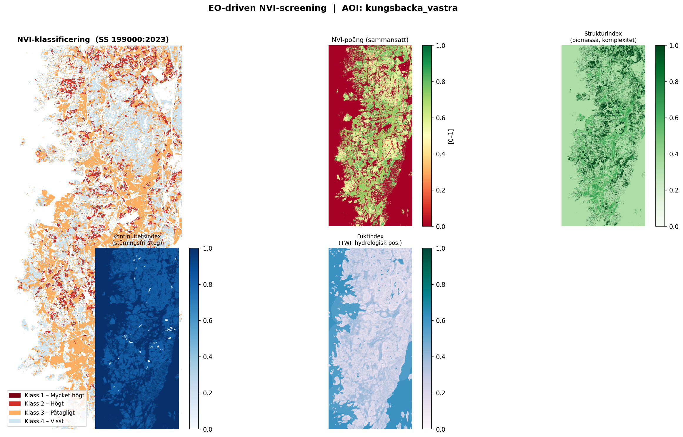
A reproducible Python pipeline that combines Swedish open geodata (NMD, Lantmäteriet, Skogsstyrelsen) to produce a prioritized hotspot map for targeted field NVI (Naturvärdesinventering) surveys. The methodology and results are published as an interactive GitHub Pages site.
Study Area: Sweden (configurable AOI)
Role: Solo project
Status: Live
Live site: ulfboge.github.io/nvi
Repository: github.com/ulfboge/nvi
Methods & Tools
Data Sources
- NMD (Nationellt Marktäckedata) — national land cover
- Lantmäteriet — topographic data and administrative boundaries
- Skogsstyrelsen — forest stand data
- SLU SOS — species observations (API)
- Swedish Red List (CSV) — threatened species
- Protected areas (Naturvårdsverket WFS)
Processing Steps
- Download and preprocess NMD and Lantmäteriet layers
- Compute ecological indices (woodland age, wetland, habitat connectivity)
- Overlay species observations and red-listed species distributions
- Build prioritized hotspot model combining multiple indices
- Export hotspot raster and vector layers for field use
- Generate showcase figures for GitHub Pages
Tools Used
| Tool | Purpose |
|---|---|
| Python / GeoPandas / rasterio | Data processing and index computation |
| PostgreSQL + PostGIS | Spatial data management |
| QGIS | Visual QA and cartographic output |
| GitHub Pages | Results publication |
Key Features
- Fully reproducible: runs from raw open data downloads
- Configurable AOI and index weights
- Integrates species observations and red-listed taxa
- Results published as interactive web page