Skogsmonitor – GEE App Demo
Overview
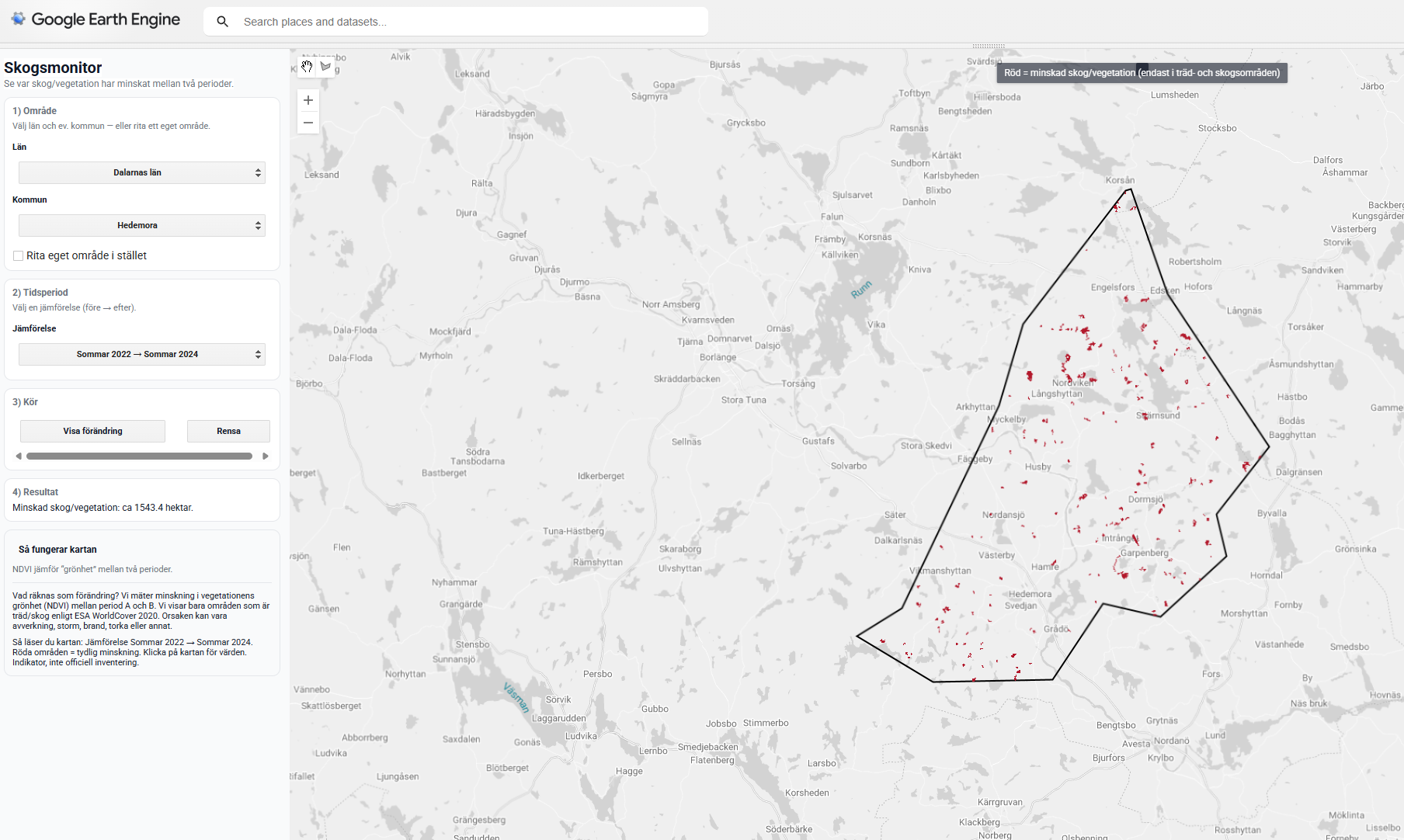
A Google Earth Engine (GEE) App demonstrating how satellite data can be used to monitor forest change over time in Sweden. Designed for environmental NGOs and non-profit use, the app makes NDVI-based change detection transparent and pedagogically accessible without requiring technical GIS skills.
Study Area: Sweden (administrative boundaries or user-drawn polygons)
Role: Solo project
Status: Live demo
Repository: github.com/ulfboge/skogsmonitor-gee-demo
Methods & Tools
How It Works
Users select an area (administrative boundary or drawn polygon) and choose two time periods (A and B) to explore:
- NDVI for period A and period B
- ΔNDVI — change between periods
- A change mask — areas below a configurable detection threshold
- Affected area in hectares
- Click-to-inspect: NDVI A, NDVI B, and ΔNDVI values at any map location
Data Sources
- Sentinel-2 MSI — multispectral imagery (10–20 m resolution)
- Swedish administrative boundaries (SCB/Lantmäteriet)
Tools Used
| Tool | Purpose |
|---|---|
| Google Earth Engine | Image compositing, NDVI calculation, UI |
| JavaScript (GEE API) | App logic and interactive interface |
Key Features
- No GIS skills required — designed for NGO non-technical users
- Configurable NDVI change threshold
- Area statistics in hectares
- Click-to-inspect values at any point