Wildlands League – Ecosystem Services & Carbon
Overview
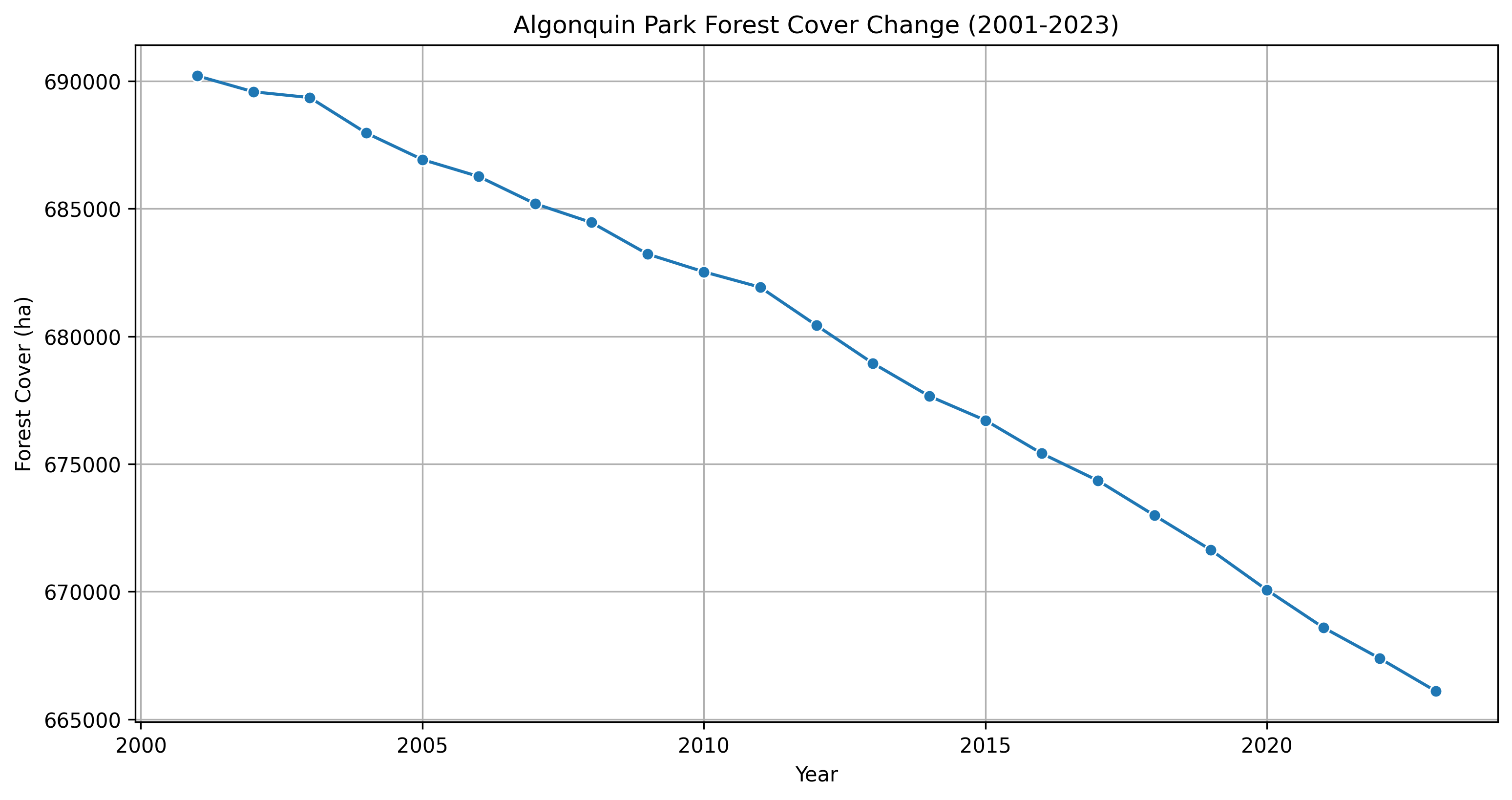
Geospatial analysis and carbon assessment tools to support the Wildlands League in transitioning away from conventional logging by generating income through ecosystem services and carbon credit development. The project establishes a spatial baseline, evaluates deforestation history, and supports selection of an appropriate carbon standard.
Client: Wildlands League
Study Area: Wildlands League forest concession (Canada)
Role: Lead analyst
Status: Completed
Repository: github.com/ulfboge/wildlands-league-ecosystem
Methods & Tools
Data Sources
- Hansen Global Forest Change (GFC) — historical deforestation
- ESRI LULC — land use / land cover
- Protected areas boundaries (WDPA)
- Project concession boundaries
Processing Steps
- Delineate project area and identify protected vs. non-protected zones
- Evaluate deforestation history using Hansen GFC (2001–present)
- Establish spatial baseline for carbon certification
- Assess economic viability of carbon credit pathways
- Support selection of appropriate carbon standard (VCS, Gold Standard, etc.)
Tools Used
| Tool | Purpose |
|---|---|
| Google Earth Engine | Forest cover analysis and deforestation history |
| Python / GeoPandas | Spatial analysis and area calculations |
| QGIS | Map production and final deliverables |
Key Findings
- Identified extent of protected vs. unprotected forest within the concession
- Quantified historical deforestation rates to support additionality assessment
- Delivered spatial baseline package suitable for carbon standard submission