Web Apps & Data Pipelines
Projects combining web development, data visualization, and automated geodata workflows.
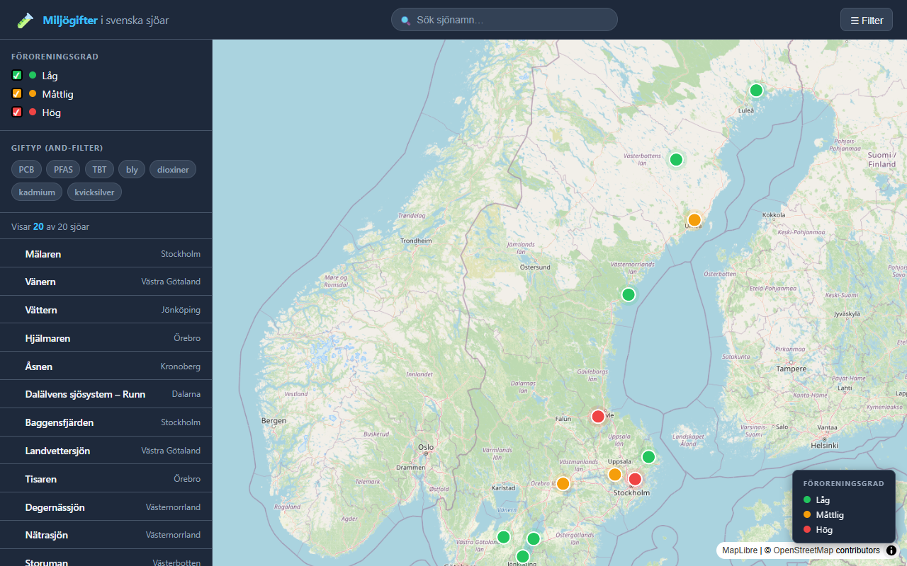
Interactive Leaflet web map visualizing PFAS, mercury, PCB, and cadmium in Swedish lakes.
JavaScript Leaflet HTML/CSS
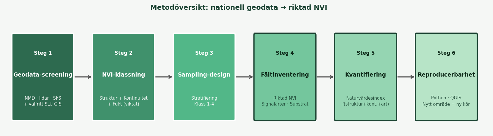
Automated Python + GitHub Actions pipeline: reads GeoPackage, calculates areas, filters, and logs.
Python GeoPandas GitHub Actions
![]()
Web application for downloading and processing geographic data from Swedish authorities.
JavaScript Web App
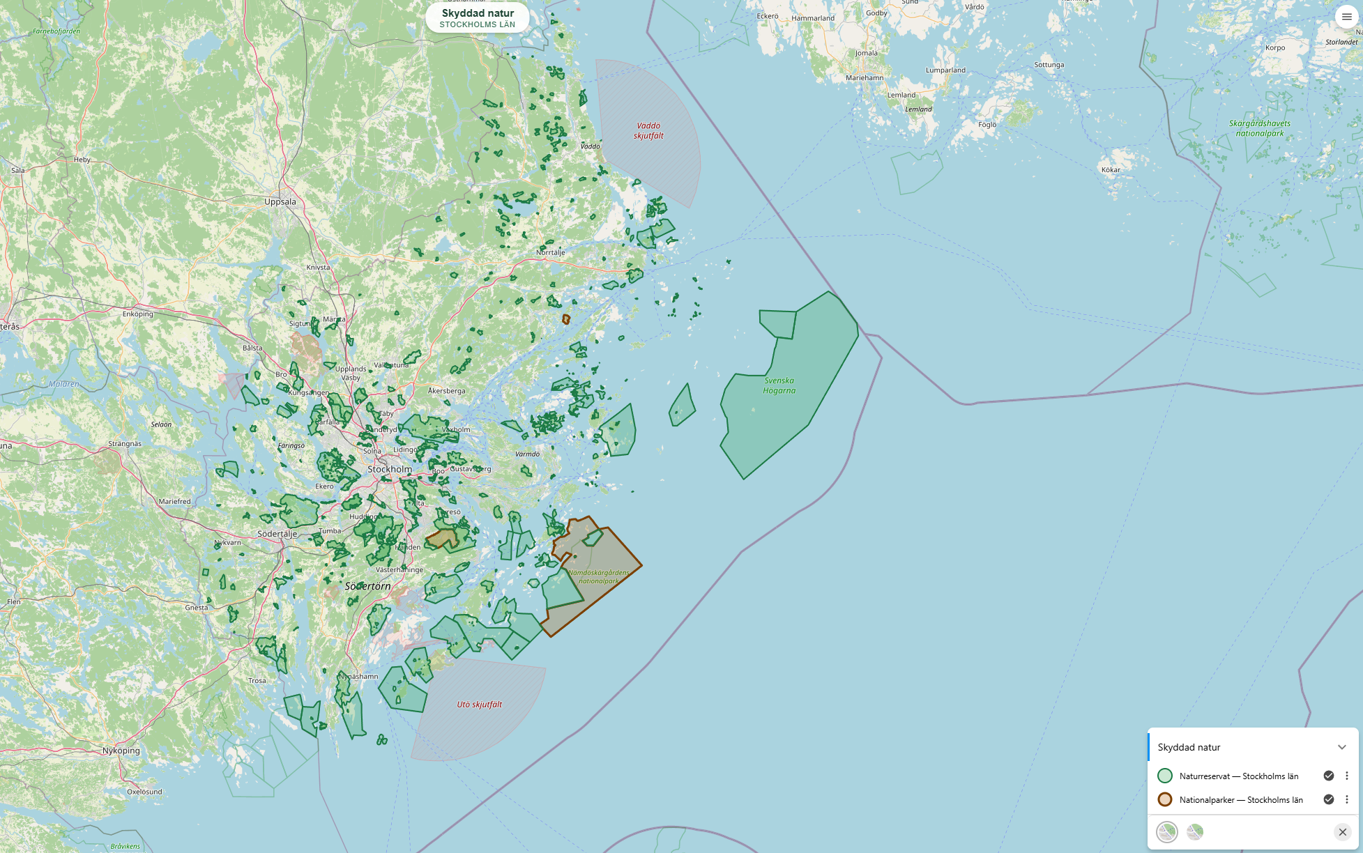
Naturkarta — Skyddad natur och skog
Web GIS portal built on Origo Map displaying Swedish nature reserves, national parks, Natura 2000, and logging notifications with clickable popups.
Origo Map OpenLayers WMS GeoJSON
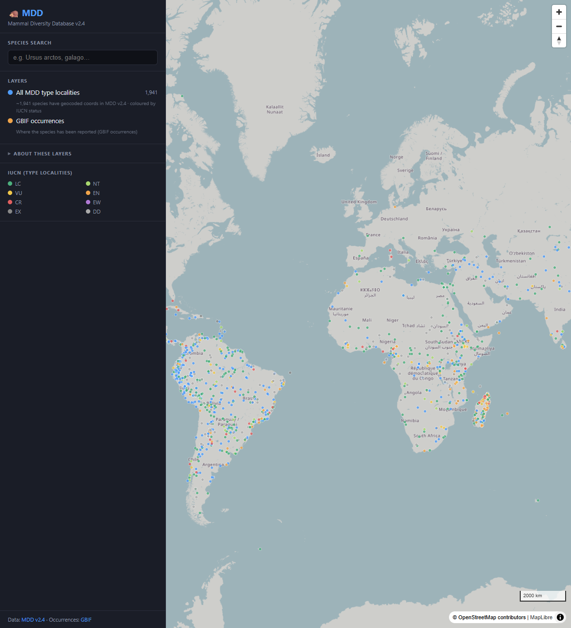
Mammal Diversity Database (MDD)
Interactive MapLibre web map and FastAPI over MDD v2.4 — 6,871 mammal species, type localities by IUCN status, and GBIF occurrence overlays.
DuckDB FastAPI MapLibre React Docker