Forest & Mangrove Change
Projects focusing on land cover change detection, forest loss mapping, and mangrove monitoring using remote sensing and GEE-based analysis.
CO2 Operate Cameroon Highlands
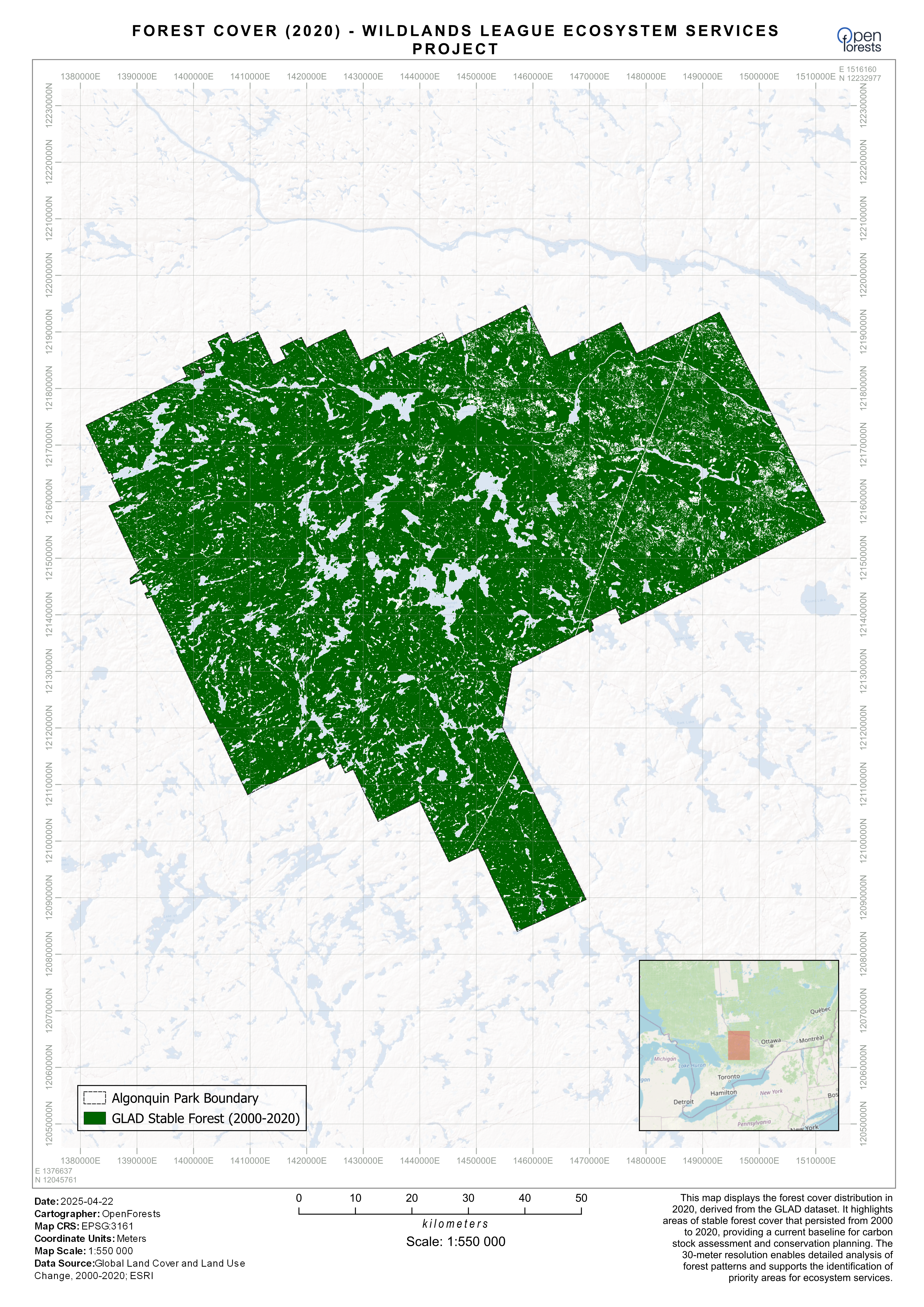
Deforestation history and forest/non-forest classification for a Plan Vivo carbon project in the Cameroon Highlands.
GEE QGIS Plan Vivo
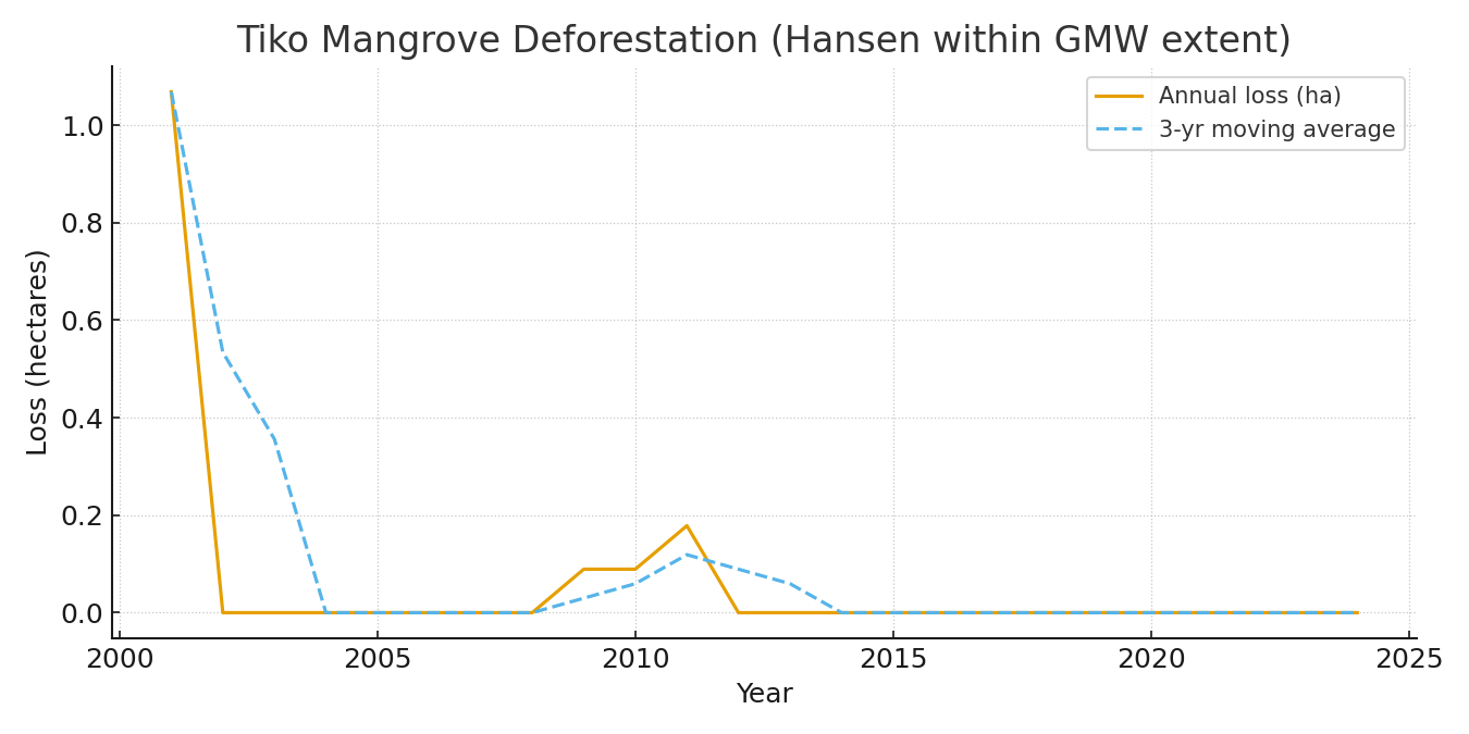
Yearly mangrove loss quantification in the Tiko area using Hansen GFC constrained to GMW v3 extent.
GEE Python QGIS GMW v3
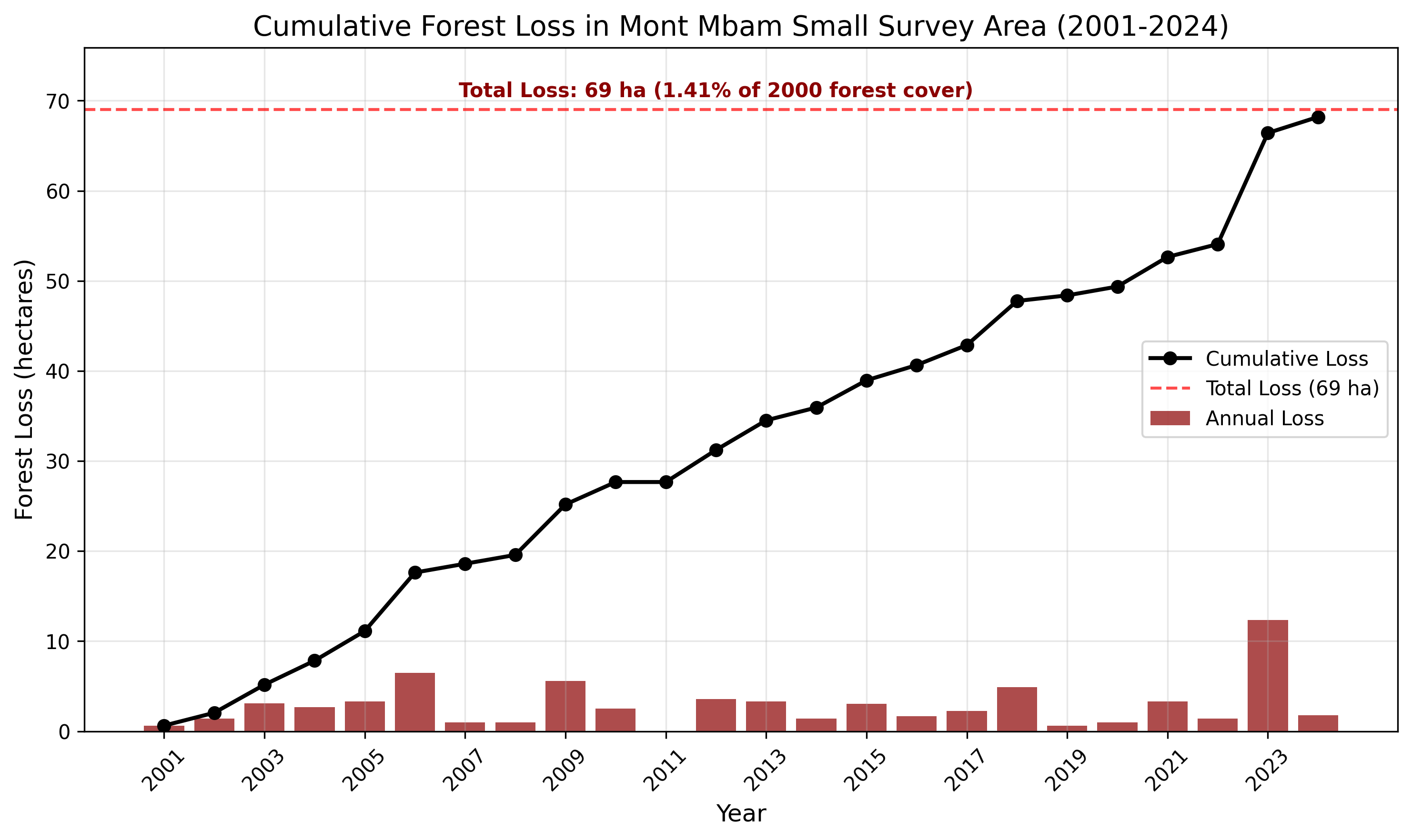
Land cover change and forest loss analysis 1987–2024 in the Mont Mbam region using CCDC and Hansen GFC.
GEE QGIS CCDC
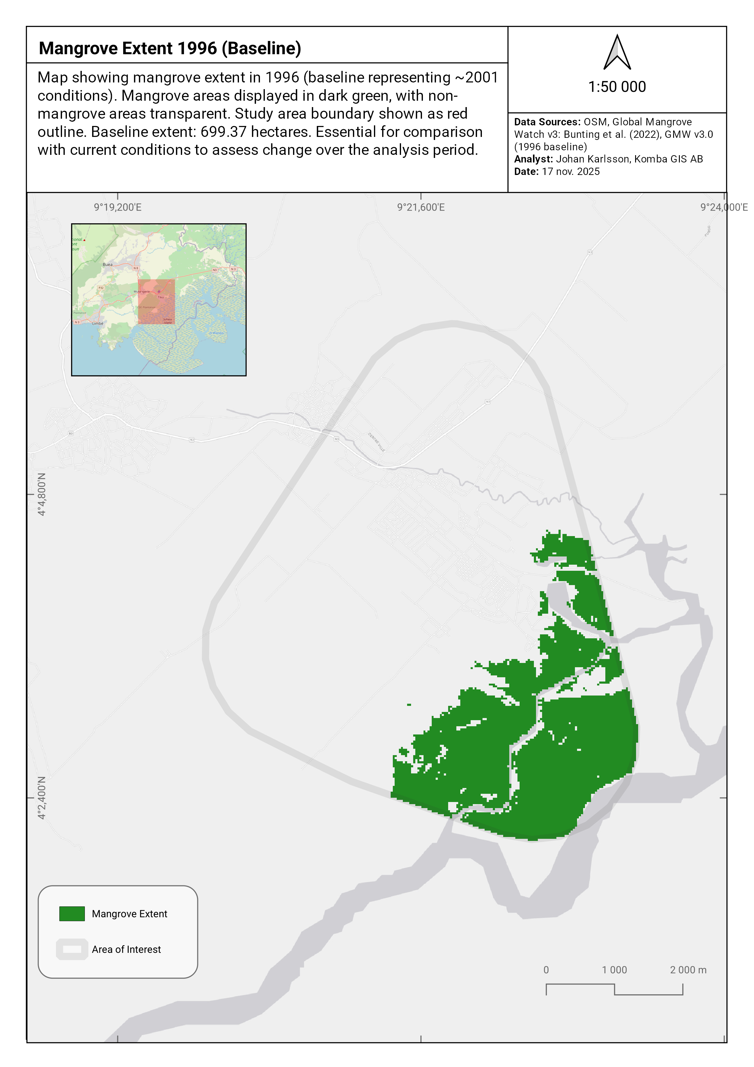
Satellite-based assessment of mangrove degradation and conservation threats in the Tiko ecosystem.
GEE Python Machine Learning
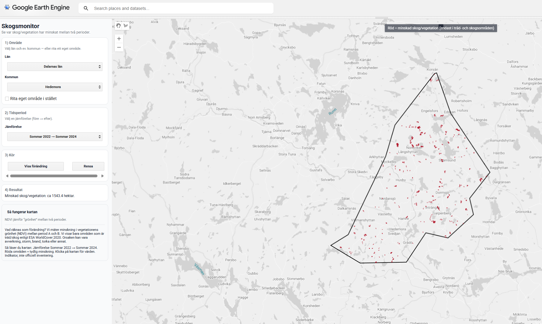
Interactive GEE App for NDVI-based forest change monitoring in Sweden, designed for environmental NGOs.
GEE JavaScript Sentinel-2