VoNat Mont Mbam
Overview
A comprehensive geospatial analysis of the Mont Mbam region of Cameroon, combining remote sensing from Google Earth Engine and QGIS to understand land cover change, fire disturbance, and forest loss dynamics over nearly four decades. The analysis was conducted for VoNat (Voice of Nature) to support conservation and management planning in this ecologically important area.
Client: VoNat (Voice of Nature)
Study Area: Mont Mbam region, Cameroon
Duration: 1987–2024
Role: Lead GIS analyst
Status: Completed
Repository: github.com/ulfboge/VoNat-Mont-Mbam
Methods & Tools
Data Sources
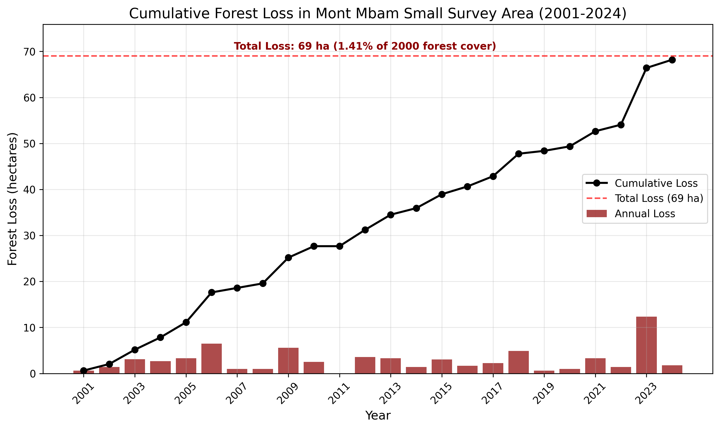
- Hansen Global Forest Change (GFC) — forest loss 2001–2024
- CCDC (Continuous Change Detection & Classification) — land cover 1987–2024
- MODIS fire data — fire disturbance patterns
- Field observations
Analysis Components
- Central Area CCDC Land Cover Analysis — land cover composition and change 1987–2024
- Hansen Forest Loss Analysis — annual forest loss patterns 2001–2024
- Fire Disturbance Assessment — fire frequency and extent
Tools Used
| Tool | Purpose |
|---|---|
| Google Earth Engine | CCDC classification, Hansen analysis, MODIS fire |
| QGIS | Map production, visualization, reporting |
| Python | Statistical summaries and time series analysis |
Key Findings
- Documented land cover composition and transitions over 37 years using CCDC
- Quantified forest loss by year and area type using Hansen GFC (2001–2024)
- Mapped fire disturbance patterns and identified fire-prone zones
- Delivered technical reports with A3 maps for client use