VoNat Tiko Mangroves
Overview
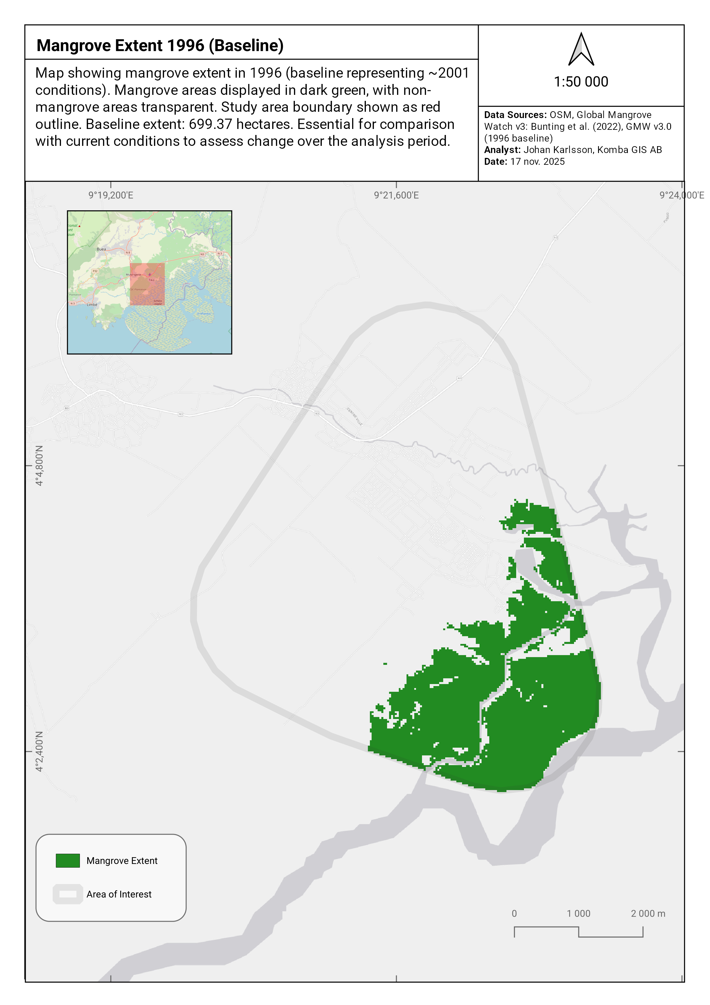
Remote sensing analysis of the Tiko Mangrove ecosystem in Cameroon, conducted for VoNat (Voice of Nature). The project uses satellite imagery and machine learning to assess mangrove degradation, identify conservation threats, and support conservation planning. The analysis combines multi-sensor data with automated change detection to produce a comprehensive threat assessment report.
Client: VoNat (Voice of Nature)
Study Area: Tiko Mangrove, Cameroon
Duration: September–November 2025
Role: Lead Analyst
Status: Report Complete — submitted to client
Repository: github.com/ulfboge/VoNat-Tiko-Mangroves
Methods & Tools
Data Sources
- Sentinel-2 multispectral imagery — mangrove extent and health
- Global Mangrove Watch (GMW v3) — mangrove baseline extent
- Hansen GFC — historical forest/mangrove loss
- Planet imagery (where available) — high-resolution change detection
Processing Steps
- Establish baseline mangrove extent using GMW v3
- Map current mangrove extent from Sentinel-2 classification
- Identify degradation hotspots using change detection
- Classify threat types (agriculture, urban expansion, aquaculture, etc.)
- Produce threat maps and quantitative summary for the conservation report
Tools Used
| Tool | Purpose |
|---|---|
| Google Earth Engine | Image classification and change detection |
| Python | Machine learning classification, area statistics |
| QGIS | Cartographic outputs and map layouts |
Key Findings
- Mapped current mangrove extent and identified degraded zones
- Classified primary threat categories and their spatial distribution
- Delivered final conservation report with maps, ready for client submission